Death Valley Days and the Weather Bomb
Death Valley National Park, California
It was Thanksgiving Day weekend again, a time when I traditionally take a 4-day camping trip. This trip also coincided with what the weather people were describing as the “weather bomb of 2019”. A big set of storms, originating along the California coast and flowing east through the desert southwest, was expected to bring heavy rain with snow in the higher elevations to the park.
The first wave of the weather bomb was expected on the day I was due to arrive. Landscape photographers often find this type of weather exciting as it brings a variety of clouds and light onto the land.
Death Valley National Park is a land of extremes, and one of sharp contrasts. In the summer the hottest temperatures in the US are recorded, with an average temperature of 116° F (46 C) in July (the hottest air temperature ever recorded in Death Valley was 134 °F (56.7 °C) on July 10, 1913). The average temperature in November, when I visited is 77° F (25C), although it hovered around 50° F (10C) during my visit. The park is a basin, surround on the east by the Panamint Range and on the west by the Amargosa Range.
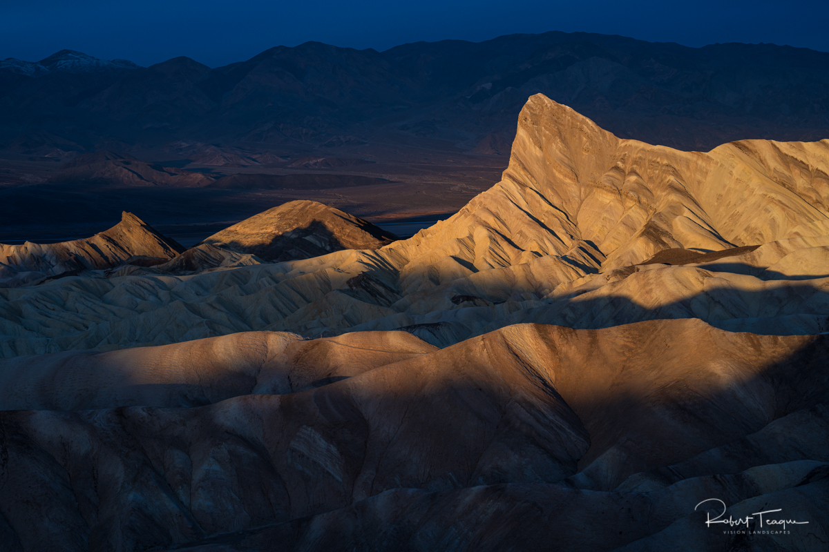
Zabriskie Point
My visit to Death Valley began at Zabriskie Point, arriving just a little before sunrise. Zabriskie Point is probably one of the most recognizable locations within the park, especially for photographers, and a natural beginning point for most visitors. It’s a short and easy walk up to the overview from the parking lot. Once you are at the overview, you can see a much of the park (it’s several hundred feet above the basin) laid out below you. Many of the most recognizable photos from Zabriskie Point are taken just beyond the rock wall that surrounds the overview, at the beginning of the Gower Gulch Trail (3 mile moderately trafficked loop which passes Manly Beacon).
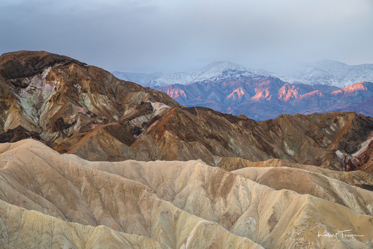
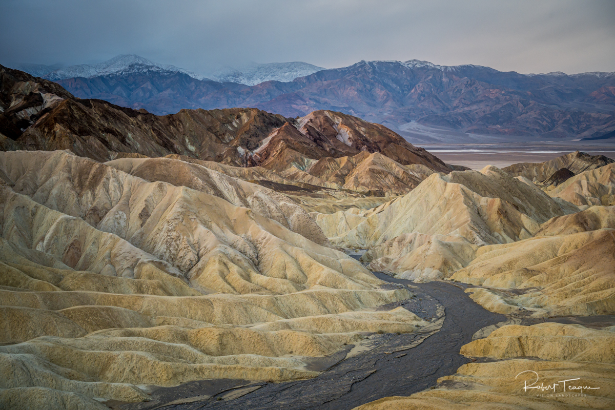
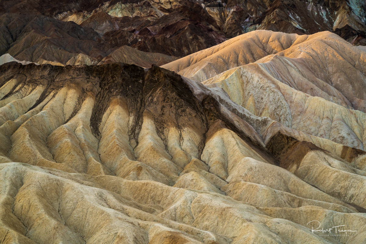
Zabriskie Point is an awe inspiring location, with it's mudstone (a fine-grained sedimentary rock whose original constituents were clays or muds) hills, its variety of colors, and the lines and patterns of its hills and ridges, topped by lava from eruptions that occurred three to five million years ago. Allow plenty of time to soak in the view.
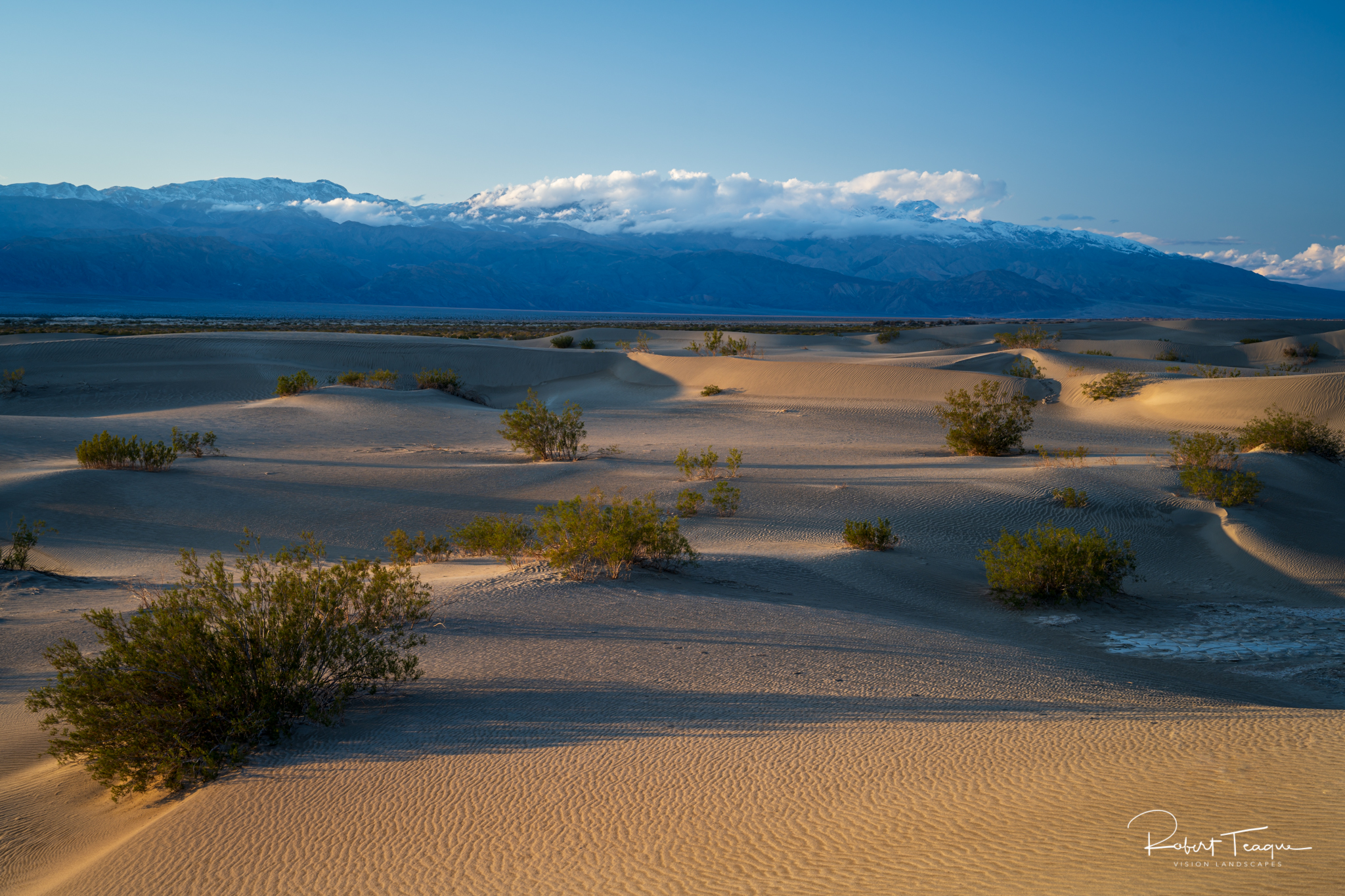
Mesquite Flat Sand Dunes
Arriving at Mesquite Flat Sand Dunes on the first day, I was met with a light rain. After waiting for 2 hours I left, planning to return the next afternoon. Arriving the next day, I found the parking lot was full to overflowing, with people parking along the main road. This is obviously a popular spot.
I knew that most of the visitors would be looking for the highest dunes that they could climb and ride sand boards down, spoiling most of the dunes for photography. Knowing this, I headed for the western edge of the dune field, away from the big dunes. The dunes were smaller, with occasional dried mud patches in between the dunes. This made walking and climbing the dunes easier and brought with it a sense of solitude. There were still the occasional foot prints and a lone figure walking, but for the most part, people stuck to the higher dunes to the east.
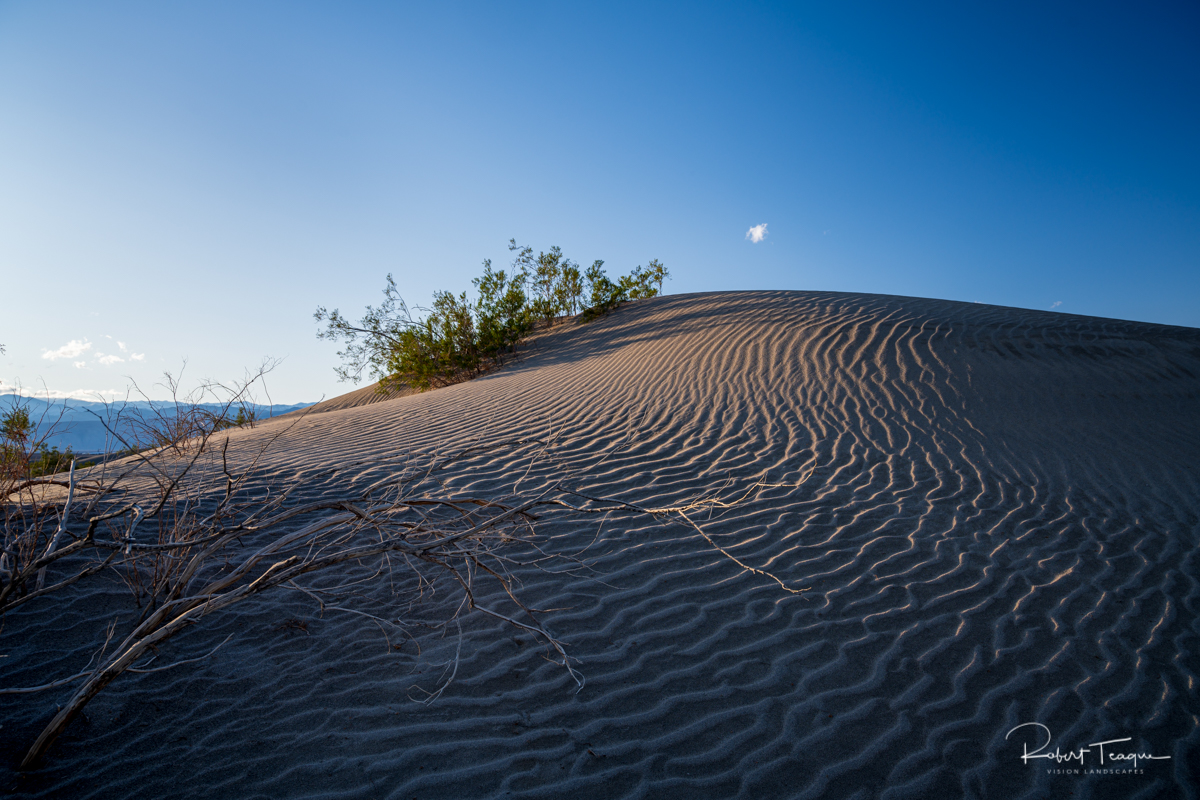
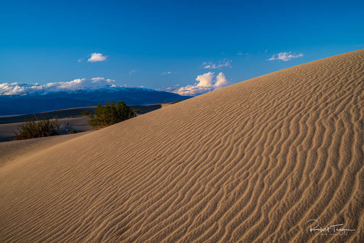
Walking along the edge of the dune field made the walking easier, but what I most like about it was the solitude. There were still the occasional foot prints and the lone figure walking, but for the most part, people stuck to the higher dunes. This allowed me to concentrate on the shapes of the dunes and patterns in the sand.
Hand of Man - Harmony Borax Works
Despite its extremes of temperature and the harshness of its landscape, Death Valley National Park was also the home of some hardy souls. The Timbisha Shoshone Indians lived here for centuries before the first white man entered the valley. Others arrived in the 1850s hoping to be part of the mining boom that was going on in California at the time.
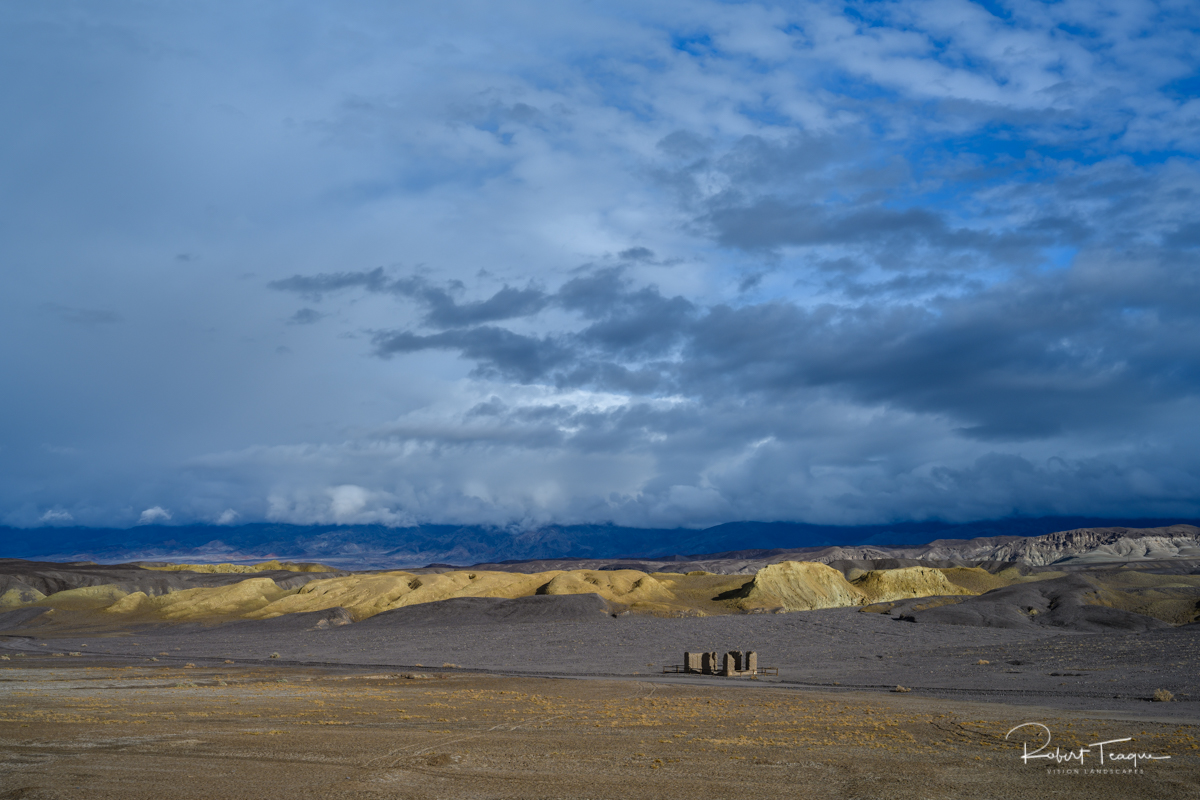
Borax was found near Furnace Creek Ranch in 1881. The Harmony Borax Works (on the National Register of Historic Places) was founded and started processing ore in 1883 or early 1884, ceasing operation in 1888. The remains of the Harmony operation are a popular stopping point in Death Valley with a short walking trail and an exhibit of one of the old 20 Mule Team wagons and processing buildings.
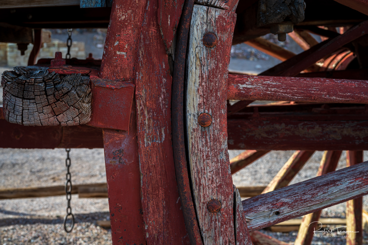
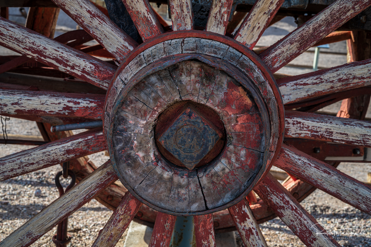
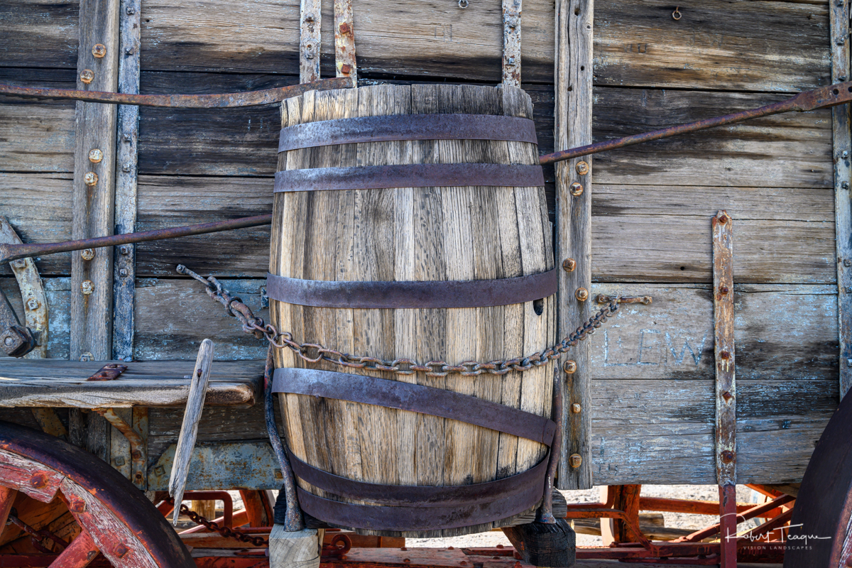
It was at the Harmony Borax Works where the famous 20 Mule Team Wagons became part of the national historical culture of Death Valley. These wagons would pull wagons piled high with the borax ore a grueling 165-mile, ten day trip across primitive roads.
Much More….
With such a short trip and the weather in the park, I concentrated on fewer areas. However, there is much more to see in the park (there are more than 3,000,000 acres of it) and will have to be done on a future trip.
Note: as of this date, in 2019, the road to Scotty’s Castle is still closed as is the castle itself. It’s not expected to open until late 2020.

0 Comments on "Death Valley Days and the Weather Bomb"